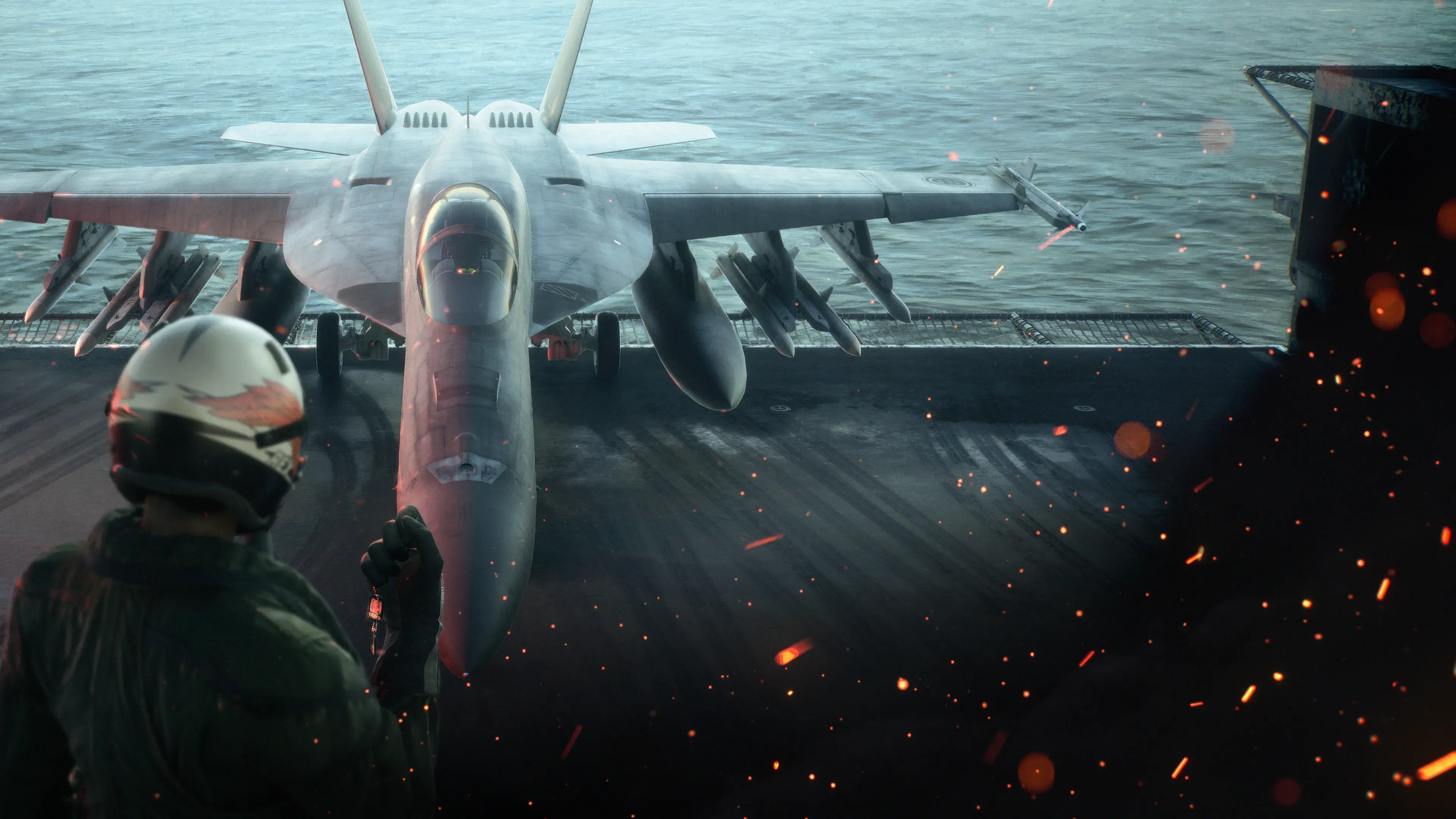
The ACE COMBAT 8 map is a map of Strangereal, the series’ fictional world. For this campaign, start with Usea, the Federation of Central Usea, and the Republic of Sotoa. The official story places the FCU under a Sotoan invasion and identifies Theve as the FCU capital. Those names describe different things: a continent, a federation, an opposing country, and a city.
A world map explains that setting. It does not provide a complete list of mission targets, enemy spawn positions, safe attack routes, or collectible locations. For a particular sortie, use its briefing and current tactical display. This guide separates those scales so that a useful geography reference does not become an inaccurate mission walkthrough.
Start with the AC8 world map
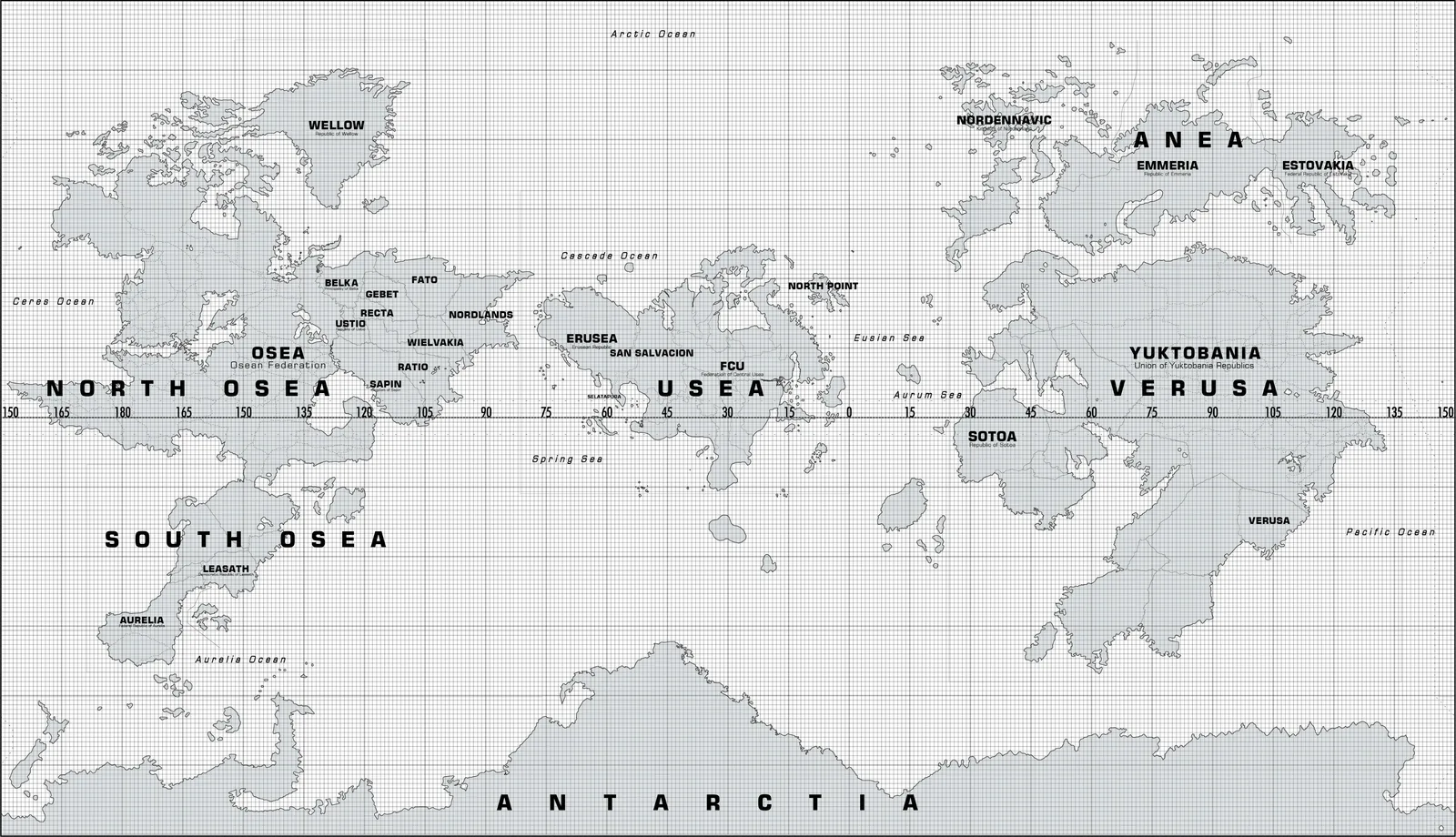
Use the world map for regional context; current mission briefings provide the objectives and local target positions.
The map’s large labels help you establish the broad layout before following individual countries. Usea sits near the center of this projection. Osea occupies the landmass to its west, while Verusa is to the east. Anea lies farther north on the right side. Sotoa appears along the southwestern part of Verusa, across the sea from Usea. This is the spatial relationship relevant to understanding the two main sides of AC8’s conflict.
The image also contains recognizable names from previous games. Their presence establishes continuity within Strangereal; it does not mean that every named country becomes a playable location in this campaign. A world map can show far more territory than the story visits. Keep that distinction when deciding whether a familiar label is a hint about an upcoming mission.
Read the names and coastlines rather than assuming that real-world geography will supply the answers. Strangereal uses real military aircraft within a fictional political and geographic setting. An aircraft model associated with a particular real country does not establish that the same real country exists on this map or that its pilot represents the corresponding real-world military.
Distinguish Usea, the FCU, Sotoa, and Theve
Usea is the continent. FCU stands for Federation of Central Usea and identifies the federation at the center of the campaign’s defending side. Sotoa is the Republic of Sotoa, the state that launches the invasion described in the opening setup. Theve is the FCU capital, which gives the Wings of Theve name its national significance.
Confusing those levels makes the conflict harder to follow. Usea and the FCU are not interchangeable labels for every geographic purpose. A continental label can encompass multiple political identities, while a country’s military can operate beyond its own border. Likewise, Theve is a capital city, not another name for the entire continent.
| Name | Scale or role | How to use it when reading the campaign |
|---|---|---|
| Strangereal | The fictional world | Establish the setting shared with much of the series |
| Usea | A continent | Locate the broad region of the FCU and its neighbors |
| Federation of Central Usea | A federation | Identify the homeland and forces described in the opening story |
| Republic of Sotoa | A country | Identify the invading state and its position on the world map |
| Theve | The FCU capital | Understand the city behind the Wings of Theve identity |
| Endurance | An aircraft carrier | Follow the crew’s mobile base rather than placing it permanently in one city |
The official opening describes most of the FCU as occupied and its military as scattered after a lightning invasion. That is a situation within the story, not a statement that every label on the printed world map has been redrawn. A political reference map and a description of current military control can show different kinds of information without contradicting each other.
Read the opening geography without later spoilers
At the beginning of the game’s setup, your pilot is rescued at sea by the aging aircraft carrier Endurance. The ship has retreated far from the front lines and carries refugees as well as military personnel. This establishes why the campaign’s immediate home is a moving vessel rather than a secure air base inside a fully defended homeland.
The story describes the FCU’s fall under the invasion in July 2029. Read that as the date of the situation being introduced, not as an instruction to match the game’s release date to its fictional calendar. The campaign takes place in its own world and period. Marketing dates, patch dates, and the date shown in a mission scene belong to different timelines.
Theve’s importance is both geographic and symbolic. A capital gives the displaced forces a concrete homeland to reclaim, while the Wings of Theve legend gives them a public image around which to gather. You can understand that connection before reading the full character histories or the later revelations about the pilot who carried the name.
For a spoiler-light map reading, stop at those relationships. Locate Usea and Sotoa, identify the FCU as the defending federation, and understand Endurance as the carrier carrying what remains of its forces. You do not need a list of late-game objectives or final destinations to understand the opening conflict.
Use the briefing for the scale of a mission
A campaign briefing is more useful than the world map for the immediate sortie. Read the mission’s objective, the places and forces it names, and any conditions it displays before selecting a route or aircraft. The world map supplies regional context; the briefing supplies the task you are actually being asked to perform.
Keep a distinction between a location name and an objective. A city or island can be the geographic setting for a mission without every contact in that area being a required target. The tactical display and mission instructions determine what matters during the sortie. Broad political geography cannot tell you whether an individual radar contact must be destroyed.
Likewise, distance on a full-world reference image is not an exact flight-distance measurement inside a mission. A mission uses its own playable area and presentation. Do not estimate fuel, a timer, weapon range, or a safe altitude by measuring the map image displayed in this article. Those mechanics require the current mission’s actual conditions.
If you are looking for a specific campaign stage, use the mission guide for that stage. Bring the location name with you so that you can identify the right scene, but keep exact routes and target sequences attached to the correct mission. A general map page should help you find the relevant guide instead of importing a walkthrough from a similarly named older level.
Follow the tactical display during a sortie
The tactical display provides local situational information at a much smaller scale than the world reference. Use it alongside the HUD, target labels, and mission instructions to understand where current contacts and objectives lie. What you can see on that display is evidence about the active sortie, not a complete political map of Strangereal.
A useful reading order is location, objective, immediate threat, and approach. First establish where the mission places you. Then identify the required task. Finally use the current contacts and terrain to choose an approach that fits your aircraft and weapons. This order keeps the geographic context connected to the practical decision without treating scenery as an objective marker.
Do not assume that a coastline or mountain visible in another player’s screenshot guarantees the same encounter state in your own run. A screenshot may come from a different point in the mission, a different mode, or a different game. Compare the title, mission identifier, and visible objective before adopting its route.
For the same reason, an unlabeled landscape image is a weak location reference. A briefing, named scene, or clearly identified game capture gives you a stronger basis for placing the image. When you make notes for a replay, include that identifying context rather than saving a scenery image and guessing its location later.
Treat older Strangereal maps as dated references
Earlier games also have official Strangereal maps. They are useful for understanding the broader series, but their political labels and historical context should not be silently substituted for an AC8 reference. A map identified with AC7, AC5, or an older release remains a reference associated with that period unless a current source establishes the relevant continuity.
The coastline alone is not a complete record of a country’s status. Political names, borders, federation membership, occupation, and military control can change across stories even when the landmass remains recognizable. Read the map’s origin and period before treating a familiar label as the current campaign’s explanation.
This matters particularly when a fan discussion compares the FCU’s representation with an older map. That comparison can be an interesting observation, but it does not by itself establish an exact newly drawn border, a confirmed annexation date, or the full political status of every unnamed area. Keep an observed label separate from an inferred history.
The world image in this guide is identified as a map created for ACE COMBAT 8. It is a geography illustration. It does not replace the campaign’s briefings when the question is which forces control a mission area at a particular moment or how the crew reaches its next objective.
Recognize fan maps and unrelated Workshop results
Searches for an ACE COMBAT map can return a community reconstruction made for another game. A Strangereal map in a strategy-game Workshop can be a fan project with its own factions, balancing choices, and invented cities. Even if it uses familiar names, it is not an AC8 installation package or an official campaign map.
Check the hosting game and the creator’s description before using such a result. A map that deliberately changes boundaries to make a different game playable has a different purpose from documenting the AC8 campaign. Its design choices should not be presented as missing facts from the official world.
Fan diagrams and video interpretations can still help you notice a place name or formulate a question. Verify that question against a current reference or an identifiable campaign scene before turning it into a guide instruction. This is particularly important for claims about exact mission positions, hidden objectives, and political changes inferred from a low-resolution image.
An interactive map would also need its own supported location data. The static world reference here does not contain a verified set of collectibles, enemy aces, mission boundaries, or click-through coordinates. A familiar interface with pins is only useful when those pins have accurate meanings; it should not be manufactured from a world image alone.
Keep Campaign and Online locations separate
ACE COMBAT ONLINE has its own progression and modes, separate from Campaign. Its air base functions as a multiplayer hub, while matches and special encounters have their own tasks. A place, target, or superweapon appearing in an Online event should not automatically be inserted into the campaign’s geographic sequence.
Emergency Sortie encounters draw on legendary superweapons from the series. That explains why a familiar name from another game can appear in an AC8-related search. It does not make an old game’s mission map a current AC8 target guide. Verify the active mode and encounter before using any specific attack route.
To find the right reference, ask what you need the map to answer. For the world and the opposing countries, use the AC8 world map. For a campaign objective, use its briefing and dedicated mission guide. For an Online encounter, use current mode and encounter information. Keeping those questions separate makes the geographic context useful throughout the game without mixing incompatible instructions.